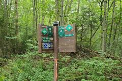
Check-Ins
| When? | Who? | Comment | Place | Location |
|---|---|---|---|---|
|
willysoffroading
|
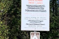
Established camp ground. $3 a person per night. Permits available at Pickle Lake municipal office. Boat launch. |
Badeswa (Mud lake) | 51.72540, -89.78357 | |
|
||||
|
NPTraveler
|
Great spot right on Bear Creek off HWY 2. I don't think 4WD would be necessary at all unless it had just rained and was muddy, otherwise any vehicle could make it slowly. The train does pass right by this creek as well above the creek on the other side, so yes you will hear the train but hey it's free and close to Glacier! You could fit a few vehicles down by the creek or there are 2 other pullouts on the road leading to the creek. There is no service on Verizon at this location. |
Bear Creek | 48.25045, -113.47137 | |
|
lmothers.others
|
Description as indicated. It wasn't busy, just a pickup with a small trailer by the river bed. Really close to highway 3. I was with a 20 ft van and could easily access the river bed even if I didn't go c |
Similkameen River | 49.14711, -120.60311 | |
|
kfdunn
|
As described by others, truck side is FULL. I’m one of ~4 on the car side. Many groups of 3-4 parking spots. IDK if it’s busier in summer, but here in shoulder season, weather is pleasant & nearly deserted car parking. |
Rest area - East Forrest City | 34.98366, -90.81239 | |
|
selkins.home
|
Excellent site, filled by early evening mid-week. |
Sawmill Point | 58.77855, -130.10402 | |
|
||||
|
untouracinq.com
|
Probably the best pizzas we had since loooong time (especially the one with blue cheese). between 420 and 580 per pizza. |
Branko’s | -23.85422, 35.54606 | |
|
ObB
|
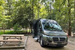
Stayed in 20 ft Ram Promaster (159"WB). Made the turn at the end which is tight to keep the drive wheels on the hard gravel, but doable if you're careful. Probably much easier with 4WD where you wouldn't need to worry so much about a wheel going down into the forest mulch. To the reviewer who had to back out - it may have seemed like half a mile, but it is only about 200 yards. Short enough that scouting on foot is definitely best to check if the turn around at the end is within your comfort zone. An alternative spot is to carry on straight instead of turning left. The road is blocked about 300 yards further down, just after the junction to another blocked road. That junction makes an easier turnaround. 47.837890, -124.235629. |
Alder Creek Rainforest dispersed campsite | 47.83824, -124.23909 | |
|
||||
|
frank.daubenton
|
Tented Chalets (12x2 sleepers) and a great communal lounge, dining room and kitchen. The tents have beds, mattresses and chairs as well as a full en suite bathroom. Bring your own bedding, food etc. Kitchen is fully equipped with everything you could need. It is a beautiful setting between the beach and the river. Canoes are available. There are lovely walks along the beach from here. Bookings through Pondo Beach Camps. Only accessable by 4x4. No reception at the campsite, but possible at the top of the hill behind the campsite. We paid 950 pn for 2 adults and 2 kids on a family special. We got two tents for this. |
Manteka - Pondo Beach Camps | -31.52236, 29.68716 | |
|
gijenne
|
great service. propane at a gas station. |
Sonic | 46.52360, -72.07128 | |
|
nutrimp
|
nice finca with lots of attractions. to sleep 10.000 COP per person. you can use the swiming pool, the two sight seeing, new bathdrooms, cold shower near the pool. and a path. you can also do the activities. huge swing 15000. Glass bridge sigth seeing 10.000. teleferico 20000. human rubber 15000 and canopy 20.000 or 40.000 the longer, per person. |
Salto El Mortiño | 1.87912, -76.20470 | |
|
2hobos
|
Stayed the night here. Parked our RV in the truck area. No issues other than having to listen to idling truck engines all night, but that appears to be how it is at rest stops. Restrooms open. No amenities. Cell reception from all 3 carriers was fine. |
Brothers Rest Area | 43.81306, -120.59936 | |
|
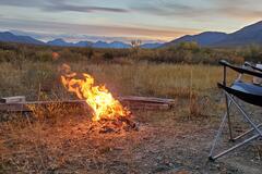
matthew.r.mcdaniel
|
level spot w/1-2 bars of Verizon4G. was able to download Netflix movies. It is actually a road junction for a closed road. fire pit. very grassy. road is rougher than 71. |
Castle Brook Road | 42.94962, -73.01689 | |
|
||||
|
matthew.r.mcdaniel
|
Actually, road us very rough. In a stock expedition I high centered two rocks and water runs naturally across road in about 10 spots. Might need 4x4. |
Castle Brook Road | 42.94962, -73.01689 | |
|
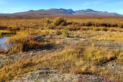
Delica_girl
|
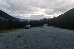
Wide open skies, mountain panoramas, dancing Aurora. A good flat gravelly spot with access to a clear gurgling creek.
|
End of the Road | 63.32591, -129.76123 | |
|
||||
|
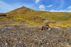
Delica_girl
|
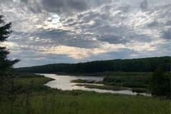
This view never gets old! Most gorgeous spot halfway up the mountain road towards the abandoned Mactung Mine site. Take the right fork a few hundred meters before getting here. Stay out in the open when buggy, hide away when windy. Hike the steep access road to the mine, about 5km for historic and even more alpine experience. 4x4 could drive all the way up, but the road is currently blocked by a small landslide. |
Mactung half way | 63.27857, -130.08238 | |
|
||||
|
lmowers
|
We're a bit conflicted about camping here. It's Yurok land, and there are ceremonial grounds within eyesight of this location. I've seen mentions of these being tribal campgrounds (for use by the Yurok), and I think it's technically trespassing to camp here. We stayed for one night (in a tent), and didn't have any issues. But still, I don't think I'd recommend coming if you have other options. |
Klamath Bay | 41.53602, -124.07589 | |
|
Kip stone
|
horrific road getting in, very washboard, very washboarding. the camping area was fine I was the only person here. very close to hobo Hot springs if that's what you're looking for. very quiet then a couple cows mowing, there is a bathroom didn't need it. level sites, I don't think an RV would work here but vans and people with smaller campers would be okay. I went to the right not the left side. |
Foote Public Access - North Platte River | 41.50869, -106.84074 | |
|
Bigfoot
|
As describe, we had a good night, very near of the beach and downtown |
Park near Beach | 49.49985, -119.60641 | |
|
hannokolvenbach
|
Got this tip from my Spanish teacher in town. It's the place where all the international restaurants by their internal ingredients. The place is run by an English (?) guy and he drives to Guatemala city every week. Very good prices. Lots of cheese, meats and Italian products (as well as drinks / rums). A bit hard to find: Next to a pharmacy is a red door. If the place is open there will be a sign "open / abierto" and you can knock on the door to get in. They are open every day from 9:00-15:00 except Sundays. |
Red Door: International Food Warehouse | 14.69468, -91.27030 | |
|
our_heroes_headstones
|
One of my favorite spots!! Very, very quiet at night! Great stargazing and wildlife all over, including wild horses!
|
Big Sandy Recreation Area | 42.25913, -109.42808 | |
|
kristinadiazrn
|
Great state park! Big sites that are very level. Cost for electric is about $44 with tax. |
WestMoreland Stare Park | 38.16747, -76.86923 | |
|
||||
|
rolling_tucker
|
Just as described, super beautiful place close to Ponte de Dios and Cascada de Tamasopo.
|
El Atrancón | 21.94760, -99.39533 | |
|
alyssafolck
|
Stayed here 2 nights. nice views, very quiet, would stay again! |
Willow Creek Reservoir | 47.49779, -112.41734 | |
|
Billie Whizz travels
|
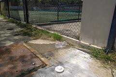
at the end of the all weather sports facility, on the side walk, small white cap.... unscrew it and you have a potable water tap |
on the side walk | 8.94019, -79.55428 | |
|
||||
|
TomandJacki
|
I hesitate posting this so we can try and keep this place to ourselves, but you should know. We had a nice spot on the river and received some nice new neighbors late in the night. All in all worth the drive. |
Peminee Falls riverside | 45.59245, -87.77606 | |
|
ibuprofanity
|
Large flat area just up the logging road, nice and flat with great views. Some people seemed set up for a while with their dirt bike. |
Duffrey Lake | 50.35395, -122.53315 | |
|
||||
|
ToozPooz
|
Just a small clearing off the side of an FSR. Road in is smooth gravel, the only part my low-clearance 2WD car struggled with was getting up over the berm on the side. Take it slow and at an angle and you’ll have no problem. Nice views of the river and sounds of trees rustling. |
Forest Service Road | 49.67777, -87.31629 | |
|
||||
|
ponti33602
|
Small Rigs. Has Fire Rings. Great for a night. Paved road getting to it as well. |
Harshaw Road Coronado Natl Forest | 31.51480, -110.70403 | |
|
||||
|
ccoffgrid
|
Primitive tent camping is $35 per night for non South Carolina residence. Google maps on this site has directions wrong but use Google maps off this site and you’ll find it. The park entrance is different is all. Dogs are allowed on the beach before 10am and after 5pm. Yay. This is a nice park. |
Myrtle Beach State Park | 33.65100, -78.93004 | |
|
||||
|
me
|
Really beautiful spot! If you follow the little road to the end (be aware of deep puddles) you can almost sleep on the beach, although that's a quite popular spot among the local fishermen. You have a beautiful view on where the river flows into the sea and are almost completely hidden from everyone else! It is close to the main road and you do hear it in the distance but that's almost surpassed by the sound of the waves. Mosquito repellent recommended ;-) |
Sangro river | 42.23466, 14.54218 | |