Check-Ins
| When? | Who? | Comment | Place | Location |
|---|---|---|---|---|
|
sofi.dottori
|
100pppn. Basic 89%.. Lets say the welcome back to South Africa campings if u return from Namibia! Some spots without light. Toilets ok, the only thing we considered average level. |
Springbok Caravan Park | -29.67242, 17.90040 | |
|
cyfrowinomadzi.pl
|
There are two or three other places nearby where you can park for the night and enjoy the views. When we were there the village was deserted, all hospedajes and restaurants closed and no restrooms in sight. Cascadas are okay, but not worth a huge detour. If coming from Lima note that approach from San Mateo/Chicla is a 5-6h (100 miles) long drive on dirt tracks. |
Roadside with waterfalls views | -12.11504, -75.82531 | |
|
J
|
The coordinates provides are to a rich neighborhood in CA w/o a lake. The URL corresponds to a spot near 37.30217466668311, -115.12492345071436 (per Google) |
Upper Pahranagat Lake | 37.30217, -115.12493 | |
|
Barry'sBeachResort
|
Iam the owner updating my place to add images |
Barry's Beach Resort | -5.70221, 38.89579 | |
|
Jetogi
|
In a valley of WVa. No cell signal for me. |
Lower Glady Dispersed campground | 39.00821, -79.61397 | |
|
Fernando Quevedo
|
I have been there in 1995, spent the night near the falls on my ground tent. Lions came at night and keep wandering around the camp in the darkness, I can occasionally hear only their heavy breathing when they pass near the tent, what a night! I couldn't sleep at all, very scary night! |
Makalia Falls Public Campsite | -0.49066, 36.08163 | |
|
Escape Mog
|
Small free camping area in Mark Twain forest with about four sites. Near a boat ramp and favorable fishing. Locals can be loud and ignorant. |
Bismark Lake | 37.73182, -90.63840 | |
|
@feralEXPRESS
|
awesome place to stay the night. I wish we could stay longer.
palapas are super nice with electricity.
|
Fidel's El Pabellón RV-Park | 30.37051, -115.86379 | |
|
joe.kleiber
|
At an intersection with a blocked off old road, enough room for one, maybe two close vans. a little sloped downhill but laterally flat. No traffic in the afternoon/evening and only two trucks at about 9am. Nice little coffee walk up the blocked trail to a lookout over the little canyon. |
NF-2027 pullout | 44.40789, -122.42561 | |
|
joe.kleiber
|
A little offshoot with space for a few vans and two fire rings already here. Kind of lumpy, but can get really level with a little maneuvering. |
Trout Creek Rd campsite | 44.53478, -122.45347 | |
|
IT ELEPHANT TOURS
|
This place of It Elephant Tours is open |
Nima Walking Tours | 5.58908, -0.19683 | |
|
marcwachsnicht16
|
Nice place to hang out for a day. A little bit of road noise. We found high bush cranberries here. |
48 mile ponds access | 64.99511, -146.22144 | |
|
Braam Geldenhuys
|
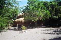
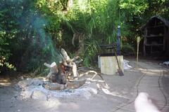
We stayed December 2003 - January 2004.
|
Pomene Village Camp | -22.92499, 35.59536 | |
|
||||
|
Andy
|
Place to car can while I visit the national parks. |
james leach | 38.57381, -109.54621 | |
|
David Atacama
|
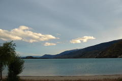
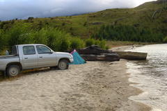
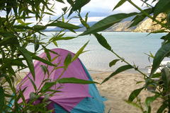
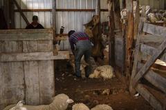
I stayed here with my wife on 15th January 2005! Yes, 2005! On a tent by the lake... Just checked my old pictures! Amazing spot. I remember the host showed us the whole farm the next morning! Just thought I could add a copule of old pictures... |
Camping on campesino farm at small beach | -46.50107, -72.71924 | |
|
||||
|
Total Escape
|
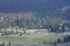
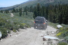
High Elevation 10,000 feet - Eastern Sierra Bliss at Upper Baker Creek in summer months. This hard to reach creek camping spot is lush and shady, and takes a full day to reach it (all on dirt roads) Via Coyote Flat OHV area, just west of Bishop, California. High clearance and 4WD needed to navigate the dirt roads around here and a hard copy Inyo National Forest Map |
Baker Creek | 37.17116, -118.46356 | |
|
||||
|
michellefoverton
|
Love this place, beautiful walks, and fun for the kids. |
Battle Ground Lake State Park | 45.80296, -122.48924 | |
|
Landcruising Adventure
|
Beach town bordering Lagoa dos Patos, with several campsites. We camped next to the waterfront. |
Arambaré - wild camp | -30.91198, -51.49640 | |
|
Landcruising Adventure
|
Cassino. A beach town south of Rio Grande with several campsites. Price low season: R$ 10 (2 persons and car) Price: R$10 per couple + vehicle |
Cassino | -32.18687, -52.16475 | |
|
Vamos Viendo
|
Hay cabañas y también algunos apart-hotel, no es camping.
|
Hotel Vertientes del Elqui | -29.97987, -70.95549 | |
|
Landcruising Adventure
|
Spent the night in the parking lot of restaurant Wunderwald on the eastside of the river. |
Pomerode Restaurant | -26.71325, -49.16853 | |
|
Landcruising Adventure
|
In front of the church you take the narrow road on the right side of the church, following the river. After some kms you'll see an orange-colored sign listing several pousadas. Take a right and follow the road until you see a wooden gate on your right. Go through the gate, follow the track downhill and you’ll end up at the most wonderful place in the area: the Pousada of Fernando and Regina. It borders the river and has a sauna. Price: negotiable (depending on use of the sauna, eating with the family, etc) Price: Negotiable |
Pousada of Fernando and Regina | -27.85975, -49.13065 | |
|
Landcruising Adventure
|
Back on the off-road between Urubici and Corvo Branco, you continue eastward. You'll find a sign on your left to Rio Canoas, and following this you will arrive at the . We camped on the premises. Beautiful walking area. |
Rio Canoas wild camp | -28.03017, -49.37540 | |
|
Landcruising Adventure
|
There is an off-road east of Urubici, leading to Corvo Branco. On this road you'll find a sign saying Morro Igreja. Following this sign you'll find another sign for the waterfall. We camped on the property of a restaurant next to the waterfall. |
Waterfall Veu de Noiva | -28.07528, -49.51815 | |
|
Landcruising Adventure
|
About 15 kms north of Urubici you see a sign saying Fazenda Hotel. We camped on the property of this hotel. Beautiful area to walk. |
Fazenda Hotel | -27.90042, -49.58583 | |
|
Landcruising Adventure
|
This National Park, also called Fortaleza, lies 40 kms north of NP Aparados. rough camping is possible outside the entrance of the park. Camping inside the camp is forbidden. Beautiful area! No entrance fee. |
Serra Geral National Park | -29.07040, -50.01853 | |
|
Landcruising Adventure
|
This park is also called Itaimbezinho. Rough camping is possible right outside the entrance of the park. Camping inside the camp is forbidden. Entrance fee: R$ 17 (2 persons and car). Price: R$17 per couple + vehicle |
Parque Nacional Aparados gate | -29.15493, -50.06032 | |
|
Landcruising Adventure
|
Somewhere in the middle of nowhere between Campos Novo and São José do Barreiro, just before the official entrance to NP da Bocaina. Beautiful spot for camping and a lovely owner, Karina. We camped in the parking lot and could use a toilet. |
Pousada Campos da Bocaina | -22.71897, -44.61847 | |
|
Landcruising Adventure
|
Two kms south of Cunha, on the road to Paraty (km 49.5). Beautiful pousada, great food, awesome sauna and swimming pool. Lovely and hospitable owners (Eduardo, Cida and Liliam). Good parking lot to spend the night and we could use the shower and toilet. Eduardo can point out a fantastic 4WD trail to NP da Bocaina (which is not mentioned on any map). |
Pousada Estalagem Shambala | -23.09663, -44.95780 | |
|
Landcruising Adventure
|
The turn-off to Vale das Cachoeiras is about 20 kms south of Cunha. Follow this route for about 10 kms to get to the pousada. Beautiful place, situated on a large terrain with river and many waterfalls. Friendly owner (Claudio) and manager. We spent the night in our car in the parking lot and could use shower and toilet |
Pousada Vale das Cachoeiras | -23.10510, -44.86803 | |