Trailhead Lago Cabrera / Vulcano Hornopiren | Tourist Attraction
Chile
Details
- Verified:
- 5 months ago
- GPS:
- -41.92159, -72.47198
- Altitude:
- 41.4 masl
- Contributor:
-
 abenteuerstattalltag.wordpress.com

Amenities
Something not right?
Description
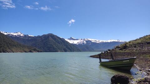
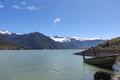
This hike to Lago Cabrera deserves as much attention as the famous Lago Pinto Concha hike! The easy sendero leads to the turquoise mountain lake Cabrera, snowcapped mountains and vulcano moon landscape inclusive. 16 km round trip, 490 m elevation gain. 4x4 vehicles could drive up even further, but the sendero becomes quite narrow - so not suitable for big rigs. After ascending a smaller paths to the right leads up to the top of Vulcano Hornopiren (sign at the crossroads).
Why? By checking in after you’ve visited a place you let others know this place is still functional. You can also add or correct any information.
Latest Check-Ins
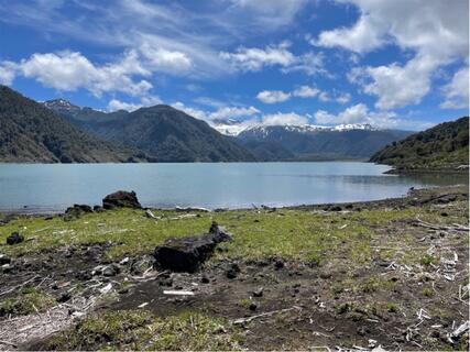
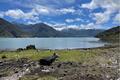
We thought the views here were beautiful, even on a cloudy November day.
A little beyond this point, but still on the ripio road, there is a little pull out on the right where you can park. It has a black sign with a white arrow, and is free. The advertised parking, which costs 2000clp, is about 200m beyond the end of the road. Our high clearance 2wd made it there, but it was a bit hairy, and maybe not the best idea in this season. To drive much further than that point, you’d need an off-road vehicle.
As we parked up, a friendly local guy called Diego offered us a lift to the lake in his truck, which we were happy to take! It was about a 90 minute very bumpy ride to the top. He is building his house next to the lake, so maybe you’ll see him if you go here :)
Lago Cabrerà is nice, but definitely not a highlight or mustsee. In the background you see Vulcano Hornopiren and Yate 🌋 You can also hike up to Volcano Hornopiren, there's a sign to the right, a bit before the lake. We didn't do it (it's about 1.000 m in altitude, so probably at least plus 2 hours one way). The trail to the lake is easy and boring (through forest). We started at the end of the ripio, it took us 1 hour 50 min. You can park at a house, they charge 2.000 Pesos. Even though we have a 4x4 we didn't drive further up and in the end we're glad we didn't. The road is so bad that you are faster by foot. And very narrow, not many possibilities to park and turn around. Also very tricky if another car is coming...
Report Check-InThe destination is a wonderful lake with awesome views of the surrounding mountains and of Volcán Hornopieren. Great for lake side picnic. But the hike itself is just ok, most of the time you are walking on a logging road. But we did the hike in 2 hours 10 min one way, and we consider ourselves very average hikers.
There is no parking at this specific ioverlander icon. But if you drive 700m onwards, there is a nice grassy field on the right side. You could probably camp there too.
4x4s with low roof can keep going but limited pull outs. But you could probably keep driving an additional 4.1km behind this marker (until the “lago” sign.
Adventurous low roof 4x4s can drive 6km all the way until the boardwalks start. We saw a pick up truck parked there, but the road is rough in some areas.
Report Check-InThis hike to Lago Cabrera deserves as much attention as the famous Lago Pinto Concha hike! The easy sendero leads to the turquoise mountain lake Cabrera, snowcapped mountains and vulcano moon landscape inclusive. 16 km round trip, 490 m elevation gain. 4x4 vehicles could drive up even further, but the sendero becomes quite narrow - so not suitable for big rigs. After ascending a smaller paths to the right leads up to the top of Vulcano Hornopiren (sign at the crossroads).
Report Check-In