Tate's Hell SF - #47 Oxbow (Pickett's Bay) | Established Campground
United States
Details
- Verified:
- 3 months ago
- GPS:
- 29.87051, -84.68292
- Altitude:
- 1.0 masl
- Phone:
- 850-697-0010
- Contributor:
-
 busbusbus

Amenities
- Electricity:
- No
- Wifi:
- Yes - Fast
- Kitchen:
- No
- Restaurant:
- No
- Showers:
- No
- Water:
- Natural Source
- Toilets:
- No
- Big Rig Friendly:
- No
- Tent Friendly:
- Yes
- Pet Friendly:
- Yes
- Sanitation Dump Station:
- No
Something not right?
Description
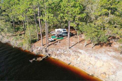
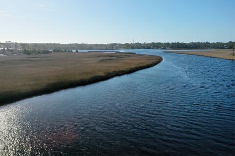
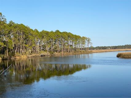
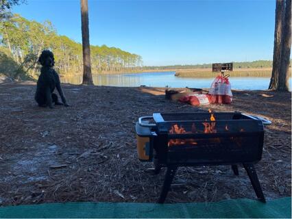
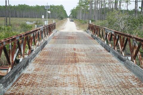
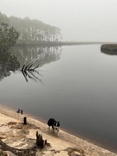
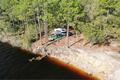
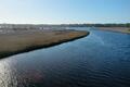
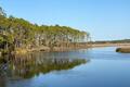
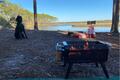
This is a primitive campsite run by the state forest which you can reserve ahead of time and is fairly cheap (considering that you can't wild camp in most of the state and national forests during hunting season). $9.17/night with $6.70 reservation fee (14 day limit). Site has a picnic table, fire ring, lots of shade, and is right on the Crooked River but no other amenities. No other campers nearby but not as much privacy as we hoped for. There was a lot of boat traffic on the river and people drove into our site either just out for the day or looking for a place to camp. After we put up a sign back on the road, we didn't have any more visitors. It's about 5.5 mi down sand/gravel roads by the shortest route (southern by Warren Bluff Rd) but that had lots of large muddy sections which would be challenging in low clearance rigs. From the north, you could take County Rd 67 to Gully Branch Rd, but that way was quite long.
A slightly longer but faster route for us with no mud/water: from Carrabelle go south on US-98 over the bridge, 1st right after bridge on FL-379, 4.7 mi (during which road becomes sand) to right on Number 3 Rd at Tate's Hell SF - Picketts Bay Tract sign, cross bridge and go 1.8 mi to second right (unnamed road), 1.5 mi to the second right where you'll see a red camp sign, 1 mi to left on Warren Bluff Rd, 0.2 mi to right on campsite entrance road marked by a post with #47 (take the first right which goes past #48 Warren Bluff site as the road is washed out about 100ft after that campsite), follow the new road about 1.2 mi to the campsite.


Why? By checking in after you’ve visited a place you let others know this place is still functional. You can also add or correct any information.
Latest Check-Ins
All other reviews are excellent but I wanted to note that I had ATT 5G 5 bars connectivity.
Report Check-InGreat group site and obviously fine for solo travelers (just a lot of room for 1 person and road noise/house noises from across the river).
Here are Google Map directions to save you time from reading other descriptions…
So the site is literally on Google Maps. Hit it and it’ll take you there. If you’re coming from the southwest (just before Carabelle and the bridge, taking a left on to 379) it’s an easy route that will bring you right in.
If you’re coming from the East/northeast, just a bit after Lanark Village on the 98, it’s going to make you turn right on to Lake Morality Road which then puts you on to the 67 heading north. Continue the Google directions UNTIL IT TELLS YOU YOUR LAST LEFT INTO CAMP - DO NOT TAKE THIS ROAD UNLESS YOU JUST WANT TO GET YOUR YA YAS out. It’s completely pointless (but fun). Another 5-8 minutes down the main road you’re on brings you to the official access point with a sign #47 on your left and an easy couple minute drive into the site.
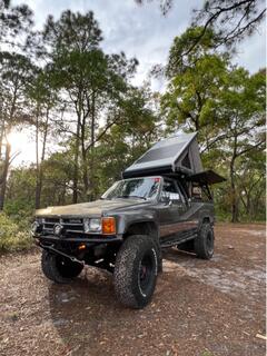
IF you make that early left I highly recommend you have nothing larger than a mid size truck/suv w/ Lo4x4, maxtracks, and a winch. I didn’t get stuck but got damn close. It’s a lot of fun but not worth it by any means.
Long story short - whether it’s a right or a left - go down the road until you see the sign for #47. Road names basically don’t exist out here
Report Check-InThe directions written down by busbusbus are exemplary. Follow them turn by turn and you will arrive easily and in good order. I had no problems in my two wheel drive, heavy Promaster (Ducato) van. The location is gorgeous and silent and bug free in a November cold front. Strong Verizon signal too. With fees and taxes it cost $31 for two nights and I wish I could have stayed longer.
To Reserve:
https://floridastateforests.reserveamerica.com/camping/tates-hell-state-forest-womack-creek-campground/r/campgroundDetails.do?contractCode=FLFS&parkId=1120132
Large flat and relatively private. Saw 1 car and a couple of fishing boats in a week. Lots of shade but open area as well if solar equipped. 5 bars of Verizon. Table and ring. A couple of houses visible in the distance. About 5 miles off pavement on dirt 2 tracks. 4wd drive optional but desirable in wet conditions as water covers road in several places.
Report Check-InThis is a primitive campsite run by the state forest which you can reserve ahead of time and is fairly cheap (considering that you can't wild camp in most of the state and national forests during hunting season). $9.17/night with $6.70 reservation fee (14 day limit). Site has a picnic table, fire ring, lots of shade, and is right on the Crooked River but no other amenities. No other campers nearby but not as much privacy as we hoped for. There was a lot of boat traffic on the river and people drove into our site either just out for the day or looking for a place to camp. After we put up a sign back on the road, we didn't have any more visitors. It's about 5.5 mi down sand/gravel roads by the shortest route (southern by Warren Bluff Rd) but that had lots of large muddy sections which would be challenging in low clearance rigs. From the north, you could take County Rd 67 to Gully Branch Rd, but that way was quite long.
A slightly longer but faster route for us with no mud/water: from Carrabelle go south on US-98 over the bridge, 1st right after bridge on FL-379, 4.7 mi (during which road becomes sand) to right on Number 3 Rd at Tate's Hell SF - Picketts Bay Tract sign, cross bridge and go 1.8 mi to second right (unnamed road), 1.5 mi to the second right where you'll see a red camp sign, 1 mi to left on Warren Bluff Rd, 0.2 mi to right on campsite entrance road marked by a post with #47 (don't follow Google and take the first right which goes past #48 Warren Bluff site as the road is washed out about 100ft after that campsite), follow the new road about 1.2 mi to the campsite.
Report Check-In