Ah Shi Sle Pah Trailhead Parking Lot | Wild Camping
United States
Details
- Verified:
- about 1 year ago
- GPS:
- 36.13996, -107.92047
- Altitude:
- 1.0 masl
- Contributor:
-
 Kevin Stotz

Amenities
- Electricity:
- No
- Wifi:
- No
- Kitchen:
- No
- Restaurant:
- No
- Showers:
- No
- Water:
- No
- Toilets:
- No
- Big Rig Friendly:
- Yes
- Tent Friendly:
- Yes
- Pet Friendly:
- Yes
Something not right?
Description
iOverlander cannot verify if wild camping is permitted at this location. It is your responsibility to verify local laws or obtain consent before staying the night.
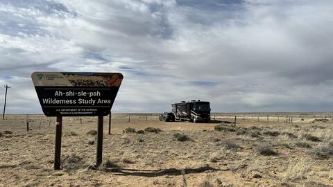
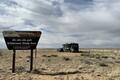
Parking lot for the trailhead. Decent size all rig size capacity. The road in is closed, so this is as far as you can drive in. T-Mobile service works and at&t.
Why? By checking in after you’ve visited a place you let others know this place is still functional. You can also add or correct any information.
Latest Check-Ins
Update from our previous post. We tried NM 57 on the way out. Parts were better, but most of it was just as bad and a longer drive than CR 7800. The last 5 miles were “paved” or used to be and comprises some of the worst parts.
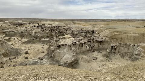
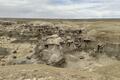
Report Check-InWe are full-timers in a 36 ft Class A with a Cherokee Trailhawk tow. We were here for a few days in mid April. The roads in can be pretty rough in places, but not too awful bad in others for dirt and gravel road anyway. I wouldn’t attempt it in anything other than a 4WD if the area were to get any significant rain, as the ruts in the road were pretty significant. There are basically two ways to get here, one is at Nageezi on Road 7800 to NM 57 (aka ISR 451 on some maps) from US 550, which is the way we came in. The 1st 4 of the 15 miles are paved, the rest is gravel and/or dirt. I was able to go between 20 and 30 mph most of the way, except in some really rough sections and at a couple of the cow guards. The other way, that BLM suggests on their website https://www.blm.gov/visit/ah-shi-sle-pah-wilderness, is to just take NM 57 off of US 550 several miles north of Nageezi, which we will try on the way out. The entrance to the trailhead is a fairly tight turn from the east, narrow, somewhat U-shaped and sporty (see photo looking NE, which really doesn’t do it justice), but after dropping our tow, we managed to get our 36’ MH up and in on the second attempt. Arriving from the east, I would suggest trying to turn around as we did and entering the trailhead from the west. To get to the wash and hoodoos it’s about a 0.6 mile walk from the trailhead. The trailhead area is nothing special, but the wash and hoodoos are really cool.
AT&T coverage was actually quite good, with 1-2 Bars of 5G service and speeds of up to 9 MB/s without a booster. We had an unobstructed view of the sky and so we were able to receive all 3 SW Dish satellites and Starlink had up to 10 MB/s. We didn’t try to load any OTA channels.
Report Check-InThe road is bad and the place is pretty boring. Need high clearance and 4WD to enter the parking lot. Wouldn’t come here again
Report Check-InTried getting here and the road was so bumpy and the weather was hot so we turned around, lots of nothing but wish we could’ve seen it. be back in winter to try again
Report Check-InThe trail is sweet! The hoodoos are amazing. Some of the coolest I’ve ever seen.
T-Mobile did not work for me. Occasionally I had one bar, but not strong enough for anything.
There was a group of car campers and a large RV when I visited with my 22ft short Skoolie. Stars were great, but it was very chilly at night in early April.
Report Check-Inparking lot for the trailhead. decent size all rig size capacity. the road in is closed, so this is as far as you can drive in. T-Mobile service works and at&t
Report Check-In