Room With A View! | Wild Camping
United States
Details
- Verified:
- almost 2 years ago
- GPS:
- 40.68859, -121.39477
- Altitude:
- 1586.7 masl
- Website:
- None
- Contributor:
-
 lyndsay1986

Amenities
- Electricity:
- No
- Wifi:
- Yes - Average
- Kitchen:
- No
- Restaurant:
- No
- Showers:
- No
- Water:
- No
- Toilets:
- No
- Big Rig Friendly:
- No
- Tent Friendly:
- Yes
- Pet Friendly:
- Yes
Something not right?
Description
iOverlander cannot verify if wild camping is permitted at this location. It is your responsibility to verify local laws or obtain consent before staying the night.
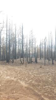
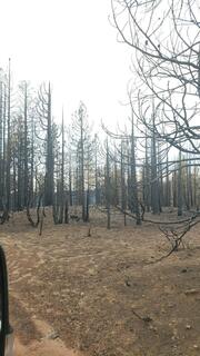
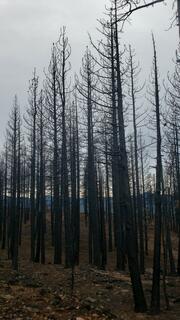
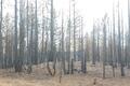
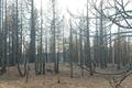
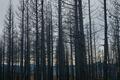
BURNED HOT IN DIXIE FIRE. DANGEROUS. Falling trees. use caution.
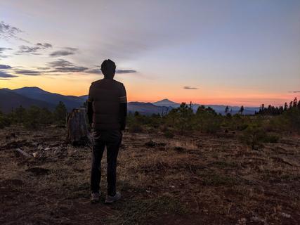
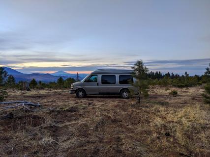
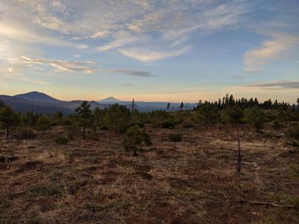
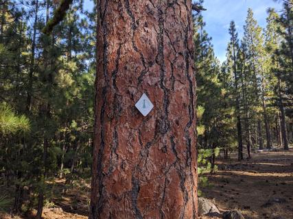
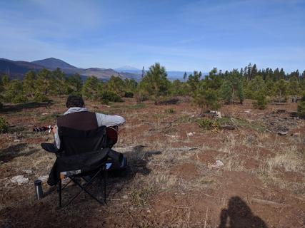
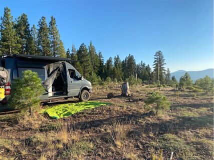
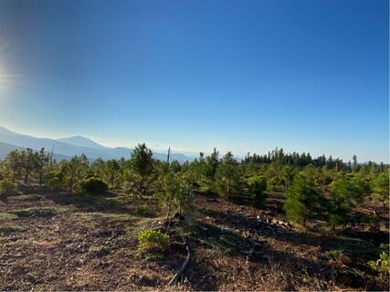
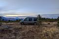
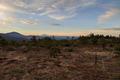
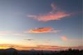
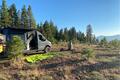
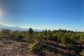
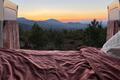
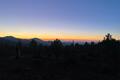
This spot features a flat open space to park or camp amidst a recovering forest of young pines. It seems a forest fire swept through here years ago, but the area is beginning to recover. Because the pines are young, and short, the view from this site is epic. You get a clear view of Mt. Shasta, 100km to the north, and a short hike along the Pacific Crest Trail (which is mere meters from this spot) offers views of West Prospect Peak.
The road in is fine for 2 wheel drive. Cars should be fine. It's a little bumpy, but nothing impassable. Turn right off the 44 onto the unmarked loop road seen on Google Maps. After about 6-700 meters you will see a rarely used road/trail leading off to the left. That road (not on Google maps) will take you to this spot. You can hear the cars on the highway in the distance below, but it's not busy at night. We slept great.
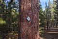
You can hike the Pacific Crest Trail for miles and loop back to the spot via the Forest Service Roads that network through the area.
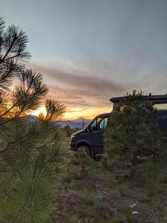
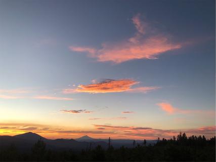
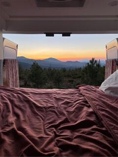
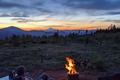
The view here won't last long as the small pines grow. Enjoy it while it lasts! Pack in and pack out. No amenities, no water, just solitude and the stars!
Photos


Why? By checking in after you’ve visited a place you let others know this place is still functional. You can also add or correct any information.
Latest Check-Ins
Beautiful place, but a little hard to find as these roads don't show up on Google Maps. We had to drive around a bit before we found it, but it was worth the effort!
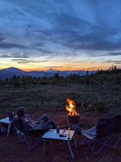
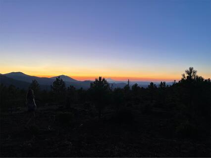
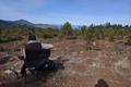
Report Check-InThis place was difficult for me to get to and I went down a few rough wrong roads first. When you first turn onto the forest road you’ll come to a right fork, but do not take that one. Next you’ll come to a perpendicular road where you could go left or right, do not take that one. Next you’ll see a road to your left, do not take that one. Then finally you will see a right where your only option is to turn right. Take that road! Shortly after turning on that road you’ll see where a burnt tree had fallen across the road and has been moved to either side. That way you’ll know you’re on the right road. Follow that for about maybe a half mile and you will see a clearing kind of up and to the left. There’s a stump about 3-4 feet tall and just behind that is a fire pit that’s how you know you’re at the right place. It was definitely the easiest of the roads once I was on the right one. Amazing sunset but since there’s no tree coverage, it gets hot early. I personally would only use it as an overnight and wouldn’t set up camp for long.
Report Check-InDefinitely one of my favorite places I’ve stayed at thus far :) overall decent service and data and definitely a view. Road was a bit rough getting here though.
Report Check-InThis place is awesome. Follow the gps coordinates listed exactly. Do not turn left as one reviewer mentioned.
Report Check-InAttempted to get here in our class c and the roads were too rough and sketchy for us. :(
The reviews and photos look amazing.
This is a forest that was clear cut and replanted. It’s a turn at the vista point, (gates closed) forest road 34N34 just off highway follow as far as you like, multiple places to park. (Google maps won’t work as internet (Verizon) is inadequate) There are multiple people parked. There are various roads that turn off this one. Where the trees are short all vehicles are visible. Some roads turn into woods so more private but the views?
Report Check-InThis is one of the best camping spots I’ve ever had the pleasure of staying at. It’s the site of a Forrest fire from the past that’s in regrowth at the top of a “mountain”. The views are 360 degrees of spectacular. You can see Shasta perfectly in the distance. It’s quite, and I was the only one up here for as far as I could see. Amazing sunset and woke up to just a bit of rain which kept the sun down as this spot doesn’t have any natural shade. Definitely recommend high clearance on your vehicle, but the road up wasn’t terrible. Verizon 2 Bars LTE. Definitely will be coming back!
Report Check-InGreat sunset with plenty of room and privacy. A bit exposed since there is not good tree coverage and got hot in the morning with little shade.
Report Check-InExcellent spot! No noise from highway for us as there was a wonderful breeze. 80 degrees at 7PM with an epic view. Road was a little washed out from recent rain but jackeeO the sprinter did fine.
Report Check-InGreat view. Wide open. End of what appears to maybe be an old logging road. Exposed to elements and sun as there are no tall trees. We chose not to stay for this reason. It was 95 degrees. This location is not new near a road but it overlooks a couple so I’m sure the sound travels.
Report Check-InBeautiful wide open views, flat ground. Passable phone reception. Only complaint is there's a tiny bit of highway noise.
Report Check-InBeautiful, secluded, quiet. Slept like a baby. Great roads- no problem for our sprinter even in rain. Woke up to rainbow over misty mountains. 1 bar Verizon LTE.
Report Check-InI forgot to mention that there are signs saying permits are required for fires, charcoal grills and camp stoves. We didn't get one at our own risk, but we saw no one the whole time we were here. I can't imagine someone coming out here to fine us, but you never know. We didn't have a fire, the area is pretty dry and we wouldn't want to be responsible for a disaster, but we did cook with our camp stove. Just be careful.
Report Check-InThis spot features a flat open space to park or camp amidst a recovering forest of young pines. It seems a forest fire swept through here years ago, but the area is beginning to recover. Because the pines are young, and short, the view from this site is epic. You get a clear view of Mt. Shasta, 100km to the north, and a short hike along the Pacific Crest Trail (which is mere meters from this spot) offers views of West Prospect Peak.
The road in is fine for 2 wheel drive. Cars should be fine. It's a little bumpy, but nothing impassable. Turn right off the 44 onto the unmarked loop road seen on Google Maps. After about 6-700 meters you will see a rarely used road/trail leading off to the left. That road (not on Google maps) will take you to this spot. You can hear the cars on the highway in the distance below, but it's not busy at night. We slept great.
You can hike the Pacific Crest Trail for miles and loop back to the spot via the Forest Service Roads that network through the area.
The view here won't last long as the small pines grow. Enjoy it while it lasts! Pack in and pack out. No amenities, no water, just solitude and the stars!