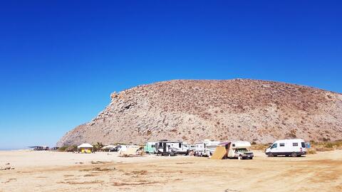
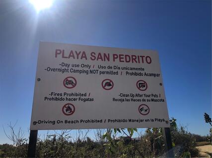
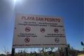
Playa San Pedrito | Informal Campsite
Mexico
WARNING: THIS PLACE IS PERMANENTLY CLOSED!
WARNING: THIS PLACE HAS BEEN FLAGGED FOR DELETION!
Details
- Verified:
- 3 months ago
- GPS:
- 23.37014, -110.20512
- Altitude:
- 2.9 masl
- Website:
- None
- Contributor:
-
 Song of the Road

Amenities
- Electricity:
- No
- Wifi:
- No
- Kitchen:
- No
- Restaurant:
- No
- Showers:
- No
- Water:
- No
- Toilets:
- No
- Big Rig Friendly:
- No
- Tent Friendly:
- Yes
- Pet Friendly:
- Yes
Something not right?
Description
MODERATOR NOTE: WARNING! Thefts and vandalism reported in this location. Please use caution.
Photos


Why? By checking in after you’ve visited a place you let others know this place is still functional. You can also add or correct any information.
Latest Check-Ins
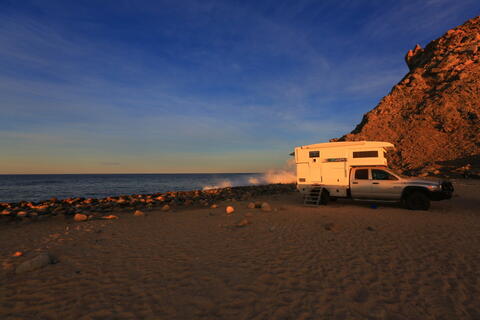
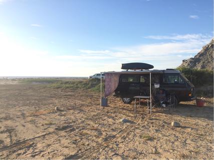
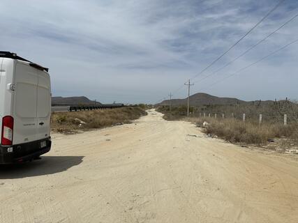
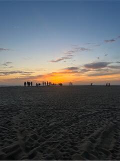
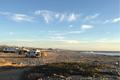
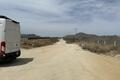
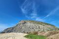
Beautiful beach! The road to get here is unpaved but it is accessible for the average vehicle. There are signs posted at the beach indicating no overnight parking allowed but it does not seem to be enforced as there were rigs there each night we stayed here.
Report Check-InGreat location!!!! Surfers and other campers. the spot is big so we had the privacy we requested.
Report Check-InOPEN ! we’ve been here for a week, police came twice and didn’t bothered us at all
Report Check-InSecond try to upload my pictures. Second try to upload my pictures.
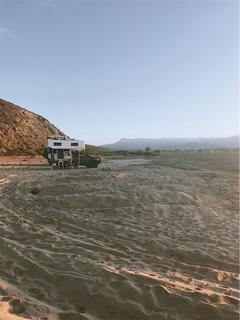
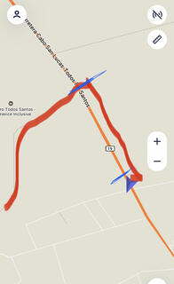
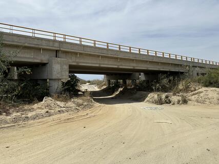
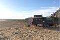
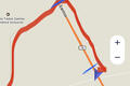
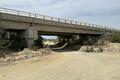
Report Check-InThis spot is not easy to find. Forget google or map-me. I can understand the previous reviewer frustration. I have uploaded a map that will help you. If you arrive by the south, the dirt road (in red on the map) is just before a bride. Take the dirt road that will fallow the main road. Stay on the road for 600 meters until you arrive to the second bridge. The road from the second bridge going west is right in the middle of the river bed. This road look like a small trail on map-me. The two blue lines on the map represent the bridges. I have also uploaded a picture when i was under the second bridge. From the second bridge go west until you arive to the spot
Report Check-InThis place is not easy to find. Forget Google map or Map-me. I can understand the previous reviewer frustration. I have uploaded a small map that will help. If you arrive by the south, the dirt road ( in red on the map) is just before a bridge. The twi blue line on the map are the bridges. Take the dirt road that will be parallel to the main road. Stay on this road for 600 meters until you see the second bridge (see picture). Turn left and to west until you hit the spot. The road is in the middle of the river bed
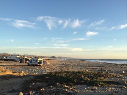
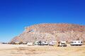
Report Check-InWe have stayed here a total of 4 days and 5 nights here so far, off and on, and it is great! There is plenty of space as there are currently probably 20+ vans and busses. 10 minute walk to the surf spot. There is a bar that plays music until about 10 or 11 but it’s not too loud or disturbing. There is a basil farm next door that often wafts delicious smells towards the campsites. We really like this spot.
Report Check-InGoogle did not get me there. The north option dead ended me into a fenced off area at a resort. The southern route looped me around some beach houses with no outlet on the beach. Even with satellite view I had to give up frustrated and headed 2 stops down to “Beach Access” which was great. Looking on satellite again looks like maybe the way in is getting under the bridge from the main road and traveling the dry river bed. If you’ve had luck please give me more detail!
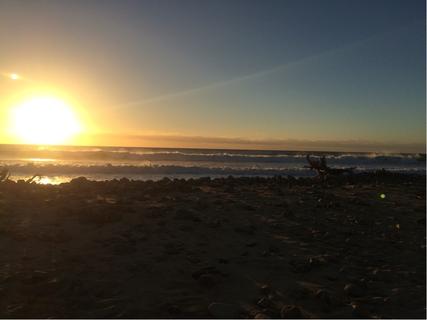
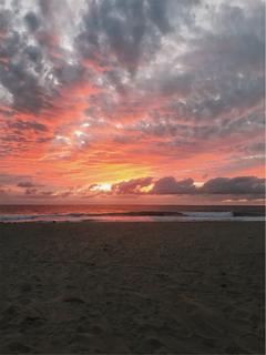
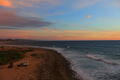
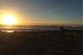
Report Check-InA little tricky to find the entrance, exit the highway (left if driving south from Todos Santos) and left again to backtrack down the parallel gravel road to cross under the highway through the bridge. First bridge is lower clearance but was fine for our Promaster. The 2nd bridge is higher. Drive straight towards the ocean on the hard packed sandy road. Watch for soft patches when you get closer to the camping area. We stayed here for a few days. It’s an awesome whale watching spot! Breaching right off shore ALL DAY! No garbages or bathrooms - take it with you when you go ☺️ Enjoy! 🐳
Hayley & Jake on YT and Instagram ☺️
Report Check-InWe stayed 3 nights. It was safe, that's about it. Mixed bag of people here. Big surfing community, upscale homeless encampment, patrons for the bar next door and the locals all park here. About 20 rigs set up, some long-timers even have structures built. Evenings are busy with bar goers and sunset watchers, mornings with surfers. Can have 40-50+ vehicles and rigs here in a moment. Nights and hot afternoons are quiet.
Report Check-InExpected this place to be full of sassy surfers and poops everywhere, but we’re pleasantly surprised! Lots of space, privacy if you go off to the right a little bit. There’s one portapotty available, also a very cool [but expensive] beach bar open in the evenings thurs-sun 200m away. Nobody sassed us. Nice, quiet stay! Lots of whales at sunset!
Report Check-InA bit too small and crowded for our liking. Nice spot otherwise if it was less busy. We moved on to La Pastora on the north end of todos santos and preferred the vibes there.
Report Check-Innice surf beach. grumpy territorial gringos. they don't like any other people to park there but the beach is not their so don't worry about them and enjoy the view!
Report Check-InNice little spot for a night or two!! 3G cell service. Nice little beach with decent waves. Not far from town or Cabo. Safe.
Report Check-InA lovely surf camp Arroyo where dogs and people can poop together in harmony.
This place was safe and full of awesome people, but the poop situation here is the worst we've encountered so far. There were times when we found it challenging to look out our windows without making eye contact with a dog or person taking a poop.
Google maps might lead you astray.
When aproaching from the south on the highway take a right just before the bridge that passes over the Arroyo. Google will tell you to turn under the first overpass but it's too low for most rigs. If you keep following the dirt road beside the highway north you'll come to a second overpass that anyone can fit under.
If approaching on the highway coming from the north you can take the right hand turn just before the Arroyo that google maps tells you to, but after that keep left until you're into the Arroyo floor.
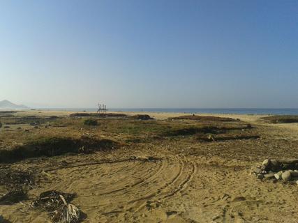
Once you enter the Arroyo you can keep to the right and end up where most people seem to be set up long term and is a ten minute walk to a sand beach, or you can veer to the left park right at the beach. The left side has a lot more traffic. There is only one road Into the private part on the middle and it's clearly marked at private.
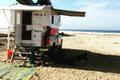
The care taker for this area is a mythical sea creature named Baltazar. He speaks English fairly well, loves Tecate lights, and is happy to arrange trash removal, water fill ups, give surf lessons and basically anything you might need a locals help with. You can find him at a hut along the beach with a sign that reads "hobbye shop". For these services a tip of a few tecate lights is customary.
Report Check-InSmall area crowded with campers but a nice spot for a night.
No garbage cans so pack it out and leave no trace.
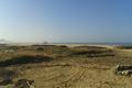
The arroyo is a great spot to post up, no facilities. A bit rocky to swim unless you walk further down to Pedrito beach.
Report Check-InThe arroyo is the only place to stay now. The campsite is closed and the owner has set up his own camper for him and a few friends. Anything past the private property sign is not for camping.
Report Check-InNice beach but a little tricky to find. First we came on 19 from south, Los Cabos. But the bridge to cross under has not enough clearance for big rigs. Then we trusted our GPS which was unfortunately leading us first on a private ranchland further north on 19 with dead end.
So best access for big rigs is, as described below, the turnoff at the sign to "Pescadero Palace". Small sign only and visible best coming from north. Turnoff is a little south of km-marker 61!
At the beach, you will end at a beach bar with small campground, but just before that sign of private property, there is space to stay overnight for free.
Took about an hour of off-roading to find this place. If you get off at the road with the house that has the sign "el pescador muerto" and farmers fields you're in the wrong spot. If you get off there you can drive a really crappy dirt road from that bridge to the correct one. It's on the inland side of the highway, head south towards los cabos. The next bridge is the one you go under, there's about 9ft clearance I'd guess. The GPS location marked in the comments below is the correct road to get off at... Which I should have listened to! That being said, the beach is awesome and was pretty full, but packed, just right. Beautiful place.
Report Check-InBeen coming here for 5 years now. Some changes taking place as they are trying to regulate camping by offering outhouses for campers and restricting beach access to others. Costs 200pesos a night to camp and use the easier access. Otherwise you have to drive down the arroyo access to get to the free beach camping on the arroyo.
Report Check-InReally nice beach. But it's not the 'Surf Camp Cerritos Beach' (that's the next one south). This place is called Playa San Pedrito.
Report Check-InBusy free beach camp. Like other said follow signs. Very popular surf spot full of very friendly people. Lots of poo around from the folks "living" here.
Report Check-InAs described. Most important points: 1.) Turn off at Sign described below.
2.) Very high tide. Parked at the road on a little mound.
Had trouble getting to this place. The maps which link up from this site to maps.me lead to dirt roads but once we got further down the road was gated off. Tried a few different offshoots. All closed off.
Report Check-InNice small beach with a handful of surfers camping overnight. Not a swimming beach but good for surfing. We got a little lost getting there - think we turned too early and got stuck in someone's farm. If coming from the north, take a right off Mex 1 at the sign for Pescadero Palace (with laundry right behind it). It's an easy dirt road that leads directly to the beach. Free!
Report Check-Incamped here but on the access road to the beach rather than the camping area with no problems. beach is cool and has surfers everywhere. options to do surf classes too. we didnt fit under the bridge that maps wants to take you in on but took the corner for Cerritos beach off the main road
Report Check-In - no surfers anymore, but still good
- will be closed this week due to private event
Nice spot, quite a few other campers, but all very nice. Beautiful beach. We got in on a dirt road beneath a bridge: 23.379756,-110.18141
Report Check-InClean beach. No services. Nice winter community. Town in walking distance. Free.
Report Check-InFree campsite that surfers use outside of Cerritos beach. ~USD Free
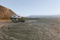
Report Check-InFree camping on the beach north of Todos Santos at old RV campground. Lots of abandoned structures, but felt very safe. No toilets, no showers, no wifi, no hookups, free!
Price: Free
Report Check-In